

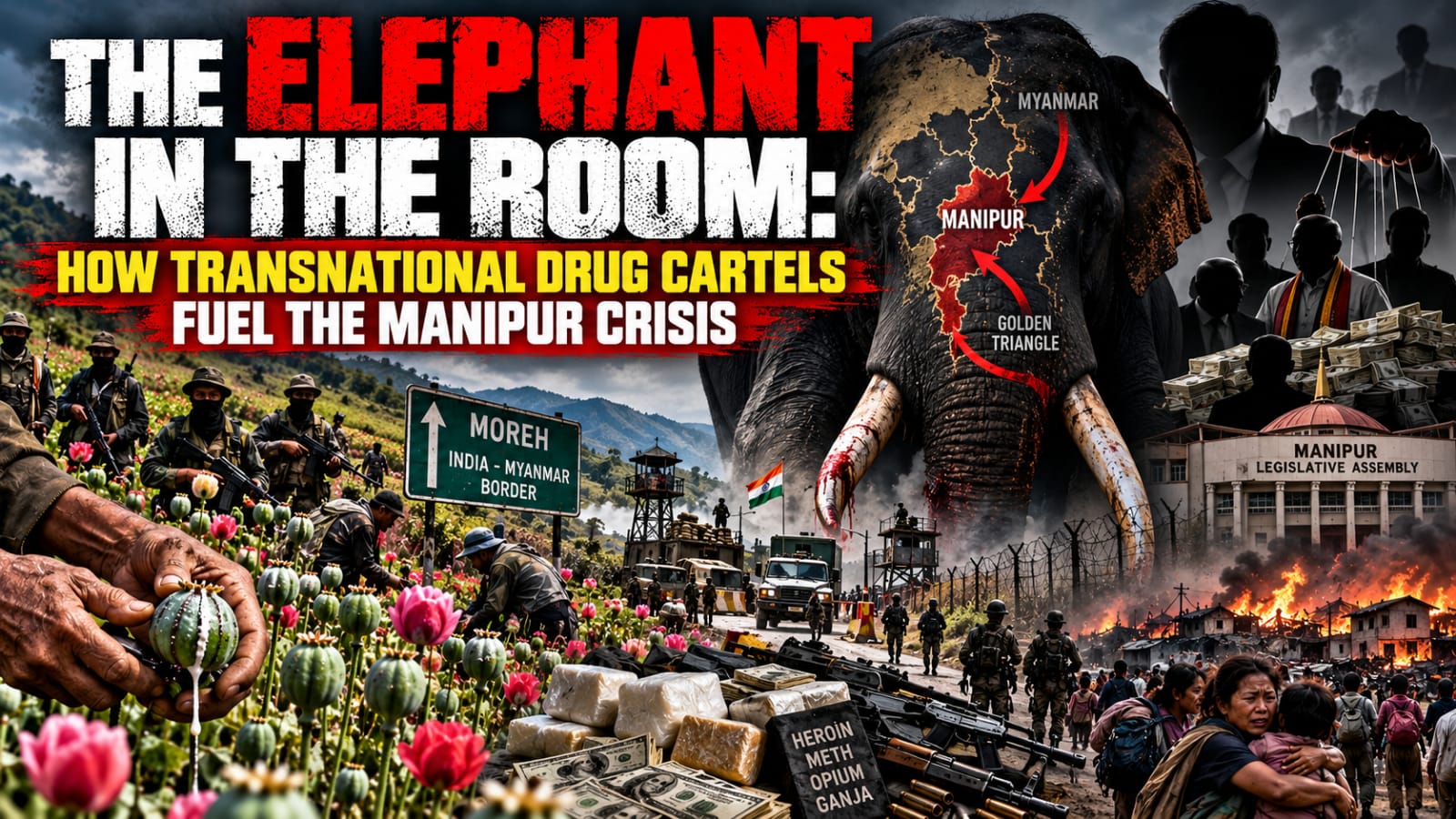
The Elephant in the Room: How Transnational Drug Cartels Fuel the Manipur Crisis

To understand the unending turmoil in Manipur from its inception to the present day, one must dare to look past the smoke screen of ethnic friction and confront the massive narcotics economy. The armed militancy, the illegal encroachments, the coercion of democratic institutions, and the tragic loss of human life are not isolated symptoms of […]

The post The Elephant in the Room: How Transnational Drug Cartels Fuel the Manipur Crisis first appeared on The Frontier Manipur.

To understand the unending turmoil in Manipur from its inception to the present day, one must dare to look past the smoke screen of ethnic friction and confront the massive narcotics economy. The armed militancy, the illegal encroachments, the coercion of democratic institutions, and the tragic loss of human life are not isolated symptoms of communal hatred. They are the calculated byproducts of a multi crore drug empire.
 

By Dr. Marc Nongmaithem

For years, the public discourse surrounding the protracted crisis in Manipur has remained rigidly locked within a bitter ethnic binary. Across valley towns and hill districts, communities, civil society organizations, youth groups, and media outlets have engaged in a relentless cycle of mutual recrimination. They identify each other as the primary existential threat. Yet, this intense polarization has completely blinded the populace to the massive elephant in the room: an entrenched, transnational drug syndicate that weaponizes identity politics to protect its illicit profits.

To understand the unending turmoil in Manipur from its inception to the present day, one must dare to look past the smoke screen of ethnic friction and confront the massive narcotics economy. The armed militancy, the illegal encroachments, the coercion of democratic institutions, and the tragic loss of human life are not isolated symptoms of communal hatred. They are the calculated byproducts of a multi crore drug empire.

THE MYTH OF A PURELY ETHNIC CONFLICT

While historical and cultural fault lines certainly exist in Manipur, the trajectory of the ongoing violence reveals a much darker economic engine. The “War on Drugs” launched by the state administration laid bare the staggering scale of illegal poppy and ganja cultivation thriving in remote hill tracts. These are not modest, subsistence farms. They are industrial scale agricultural operations managed by heavily armed cartels sitting uncomfortably close to the Golden Triangle’s transit corridors.

These cartels rely on a steady, illegal pipeline of cheap, undocumented labor sourced across porous international borders, primarily from Myanmar. This foreign labor force is incentivized and sustained by promises of shelter, food, and forged documents to gain Indian citizenship in exchange for toiling in the illicit fields and processing labs for lower wages.

A Rs 70,000 CRORE NARCO-ECONOMY CRUSHING A Rs 55,000 CRORE GDP

The sheer economic power of this criminal enterprise explains why the conflict refuses to die. Reports estimate the illegal drug market operating through Manipur has ballooned to over a staggering ?70,000 crores. This vastly exceeds Manipur’s entire official Annual Budget, which hovers around ?55,000 crores. When an illicit syndicate possesses financial war chests larger than the state government’s entire legitimate economy, it holds the absolute power to buy political allegiance, fund private armies, acquire military grade weaponry, and bankroll endless communal chaos to safeguard its profits.

COERCED DEMOCRACY AND LEGISLATIVE CAPTURE

The most harrowing reality of this crisis is how these criminal syndicates have completely subverted governance. In the hills of Manipur, elections are no longer a free expression of the public will. Armed, drug peddling factions dictate who can campaign or stand for elections, literally capturing the democratic process at gunpoint.

Consequently, these elected officials in the Manipur legislative assembly from the hills owe their power not to the electorate, but to the ruthless cartels that funded and coerced their rise. This explains the frustrating legislative paralysis and the persistent institutional reluctance to dismantle the networks. When lawmakers are captive to criminal syndicates, their primary mandate shifts from public welfare to shielding the supply chains and territory of the drug lords.

THE COMPLICITY OF THE HIGH COMMAND: FORCES LOOKING THE OTHER WAY

Adding to the outrage is the glaring paradox of Manipur’s heavily militarized landscape. The hill districts are saturated with tens of thousands of security personnel, heavily armed and equipped with advanced surveillance technology. Yet, vast swathes of illegal poppy and ganja fields continue to flourish in plain sight under their watch. While there are highly publicized eradication drives, critics argue these often serve merely as cosmetic performances.

The public is left asking an unavoidable question: how can industrial scale illegal poppy cultivation, requiring massive land clearance, daily labor, and complex logistics, thrive in zones under intense military control? This apparent blindness is not an accident. The fact that the deployed forces are deliberately looking the other way exposes a chilling reality: the high commands at both the state and central levels simply do not want the destruction of the poppy fields. This institutional complicity suggests a top down political instruction to protect the cartel economy, preserving corrupt alliances and illicit financial flows while the state burns to the ground.

THE BLINDNESS OF PUBLIC DISCOURSE AND THE MAFIA MENTALITY

Today, everyday citizens across all communities are the ultimate victims. They bear the devastating human cost, live in constant fear, and feel like orphans abandoned by the state, while the architects of the illicit economy sit back and watch communities tear each other apart. Every time pressure groups and media houses frame the conflict solely through a communal lens, they inadvertently provide perfect cover to the drug lords.

An ideological conflict can be resolved through political dialogue and compromise. However, a conflict driven by narcotics and criminal enterprise has a built in incentive never to end, a phenomenon known as the mafia mentality or mindset.

Peace directly threatens the supply lines, illegal taxation, and political protection that keep these syndicates insanely profitable.

FILE PHOTO of contraband drugs seized by Assam Police originating from somewhere in Indo-Myanmar region.


THE ONLY PATH FORWARD: A TWO PRONGED ERADICATION

The salvation of Manipur hinges on a decisive strategy. If the state is to heal, the public must awaken to the reality that the turmoil will never cease through cosmetic peace accords or surface level condemnations. The only tangible and permanent solution requires a total, uncompromised war on the drug infrastructure through two absolute steps:

  1. TOTAL ERADICATION OF CULTIVATION AND CARTEL INFRASTRUCTURE: Every illegal poppy and ganja plantation must be systematically destroyed. The armed operators and political enablers shielding them must face ruthless, unyielding military and legal action regardless of political alignments or truce pacts like the Suspension of Operations (SoO) agreements.
  2. SEAL INTERNATIONAL BORDERS AND CUT OFF THE LABOR PIPELINE: The borders must be rendered impenetrable through advanced fencing and strict technological surveillance. This will permanently cut off the inflow of cheap labor, illegal migration, and transnational trafficking routes that form the very backbone of the cartel economy.

The citizens of Manipur and the rest of India must force both the state and central governments to stop playing political games and actually deploy the massive military presence already stationed in the region for its intended purpose. Tens of thousands of heavily armed troops, paramilitary forces, and federal police are currently on the ground, yet they are paralyzed by the high command’s tacit approval of the narco economy. New Delhi and Imphal must be held totally accountable. They must be legally and publicly compelled to unleash these forces not for managing optics, but for a singular, ruthless objective: the absolute eradication of the drug cartels.

The military must be ordered by the high command to burn every illicit field, dismantle every hidden laboratory, and hunt down the syndicate bosses, rather than looking the other way to preserve fragile, corrupt political alliances. The narcotics trade was not a passive beneficiary of Manipur’s strife; it actively engineered the chaos with financial resources exceeding the state’s official GDP. True victory will only come through a full scale, militarized campaign against those pulling the strings.

Until the public, civil society, and media unite to confront the true elephant in the room and fiercely demand the total elimination of the drug cartels, Manipur will remain trapped in a manufactured cycle of violence, bleeding for the profits of a criminal few.

REFERENCES:


  1. Drug Economy & Scale of Seizures: Authorities report destroying illicit poppy and seizing drugs valued at ?70,000 crore, arresting over 2,000 to 3,000 individuals.
  2. Conflict Casualties & Origins: News reports document the origins of the conflict starting May 3, 2023, confirming that over 250 people have been killed in the ethnic violence.
  3. Myanmar Opium Cultivation Data: The United Nations Office on Drugs and Crime (UNODC) Southeast Asia Opium Survey confirmed Myanmar had 47,100 hectares under opium-poppy cultivation in 2023, an 18 percent increase from the previous year.
  4. Election Intimidation at Gunpoint: The National People’s Party (NPP) issued urgent communications before the 2022 state elections accusing militant outfits of widespread intimidation and abuse of power against candidates and voters in Manipur.
  5. Political Complicity and Cabinet Suspicions: Public records and regional media document the ongoing allegations surrounding political interference in high-profile drug cases (including those brought forward by police officer Thounaojam Brinda) and demands by the political opposition to investigate ministers linked to the drug trade.
  6. Institutional Breakdown: Human Rights groups and India’s Supreme Court have formally documented the massive breakdown of constitutional order, including the large-scale looting of weapons from state armories.


The post The Elephant in the Room: How Transnational Drug Cartels Fuel the Manipur Crisis first appeared on The Frontier Manipur.

Delhi’s Border Gambit in Manipur: Unravelling Colonial Cartography and Emerging Borderland Governance

India’s laws do not provide a uniform definition of border areas. The concept of border area is a fluid one, depending on the particular legal provisions. There are certain advantages to ambiguity as the Indian administration can adjust the borders as it sees fit. The Border Security Force (BSF) Act, 1968 allows the central government […]

The post Delhi’s Border Gambit in Manipur: Unravelling Colonial Cartography and Emerging Borderland Governance first appeared on The Frontier Manipur.

India’s laws do not provide a uniform definition of border areas. The concept of border area is a fluid one, depending on the particular legal provisions. There are certain advantages to ambiguity as the Indian administration can adjust the borders as it sees fit. The Border Security Force (BSF) Act, 1968 allows the central government to notify the areas within Manipur where the BSF has police powers. For most of the western states (Punjab, Gujarat, Rajasthan), the jurisdiction extends to 50 km from the border, but for Manipur, the entire state falls under the BSF’s jurisdiction.

By Dhiren A. Sadokpam

In the summer of 2026, as New Delhi seems to speed up its Rs 31,000-crore project to fence the 1,643-kilometre India-Myanmar frontier, a far more consequential subtext has emerged. There were also reports that the Government of India is reportedly examining a proposal to exchange approximately 1.4 square miles of territory near Manipur’s Chandel district—between border pillars 65 and 68—to expedite demarcation. The Ministry of External Affairs admits that “discussions are continuing on some unsettled sectors.”

While the government rushes to fence the border, the people in Manipur are worrying about their territorial integrity. Coordinating Committee on Manipur Integrity (COCOMI) had warned the Government of India against any move to transfer the territory of Manipur to Myanmar threatening mass agitation if the Centre attempts to do so.  COCOMI also expressed unhappiness over a MEA advisory dated 26 May, which gives a three-month time frame for demarcating the border, but makes no mention of any territorial gain for India. The organisation termed Manipur’s territorial integrity as “a red line” and said any move to shrink its boundaries would be opposed by the people of Manipur. Noting that there are stretches of disputed borders in Manipur, COCOMI said the situation is “particularly grave” in certain areas, such as BPs 64 and 68 at Molcham, 75 and 79 at Moreh and 88 and 95 at Choro Khunou. “The question also arises if India-Myanmar border talks and laying of auxiliary pillars in the Molcham sector are being done at the expense of Manipur’s territory,” COCOMI added.

For the ethnic communities whose ancestral lands straddle this frontier, the ambiguity is not diplomatic—it is existential. United Naga Council (UNC) in Manipur took the matter one step further by petitioning to the United Nations Permanent Forum on Indigenous Issues, demanding that they stop the so-called plan to give up indigenous ancestral territory and for the UN to intervene to enforce Free, Prior, and Informed Consent (FPIC).

However, it must be understood that the Indian administration has the legal leeway to redraw international boundaries without the consent of local communities due to the lack of a uniform definition of “border areas” and ambiguous legal mandates.

The Fence, the Exchange, the Unclear Demarcation

The Indian government has every reason to fence the border with Myanmar. Illegal immigration, weapon and drug trafficking, and the movement of insurgent groups and their weapons across the border prompted the Home Minister, Amit Shah, to state that this move would address “the root cause of the problem.” At the same time, it has become apparent that some of the border areas between India and Myanmar remain unsettled. The two countries signed the agreement on the border in 1967, but there are still “some unsettled sectors” along pillars 64-68 at Molcham, 75-79 at Moreh, and 88-95 at Choro Khunou. The government is considering exchanging territory to complete the demarcation in the sector of pillars 65-68 within a specified period.

The history of India’s borders with China and Myanmar shows that they were drawn based on an imperial framework. The border with Myanmar was defined in the Treaty of Yandaboo in 1826, which officially transferred Assam and Manipur to British rule. Later, in 1937, Burma was separated from India, dividing communities that had previously lived within the same administrative boundaries. The situation with China is similar, albeit more complicated, with the McMahon Line being another colonial inheritance. McMahon Line was initially opposed by the British government but was “reasserted in 1935 when Burma was separated from the Indian Empire.” The parallels between the India-China and India-Myanmar borders end with colonial roots. Each of them was imposed from outside, had ambiguous validity, and was applied unevenly.

The Legal Quick Sand of “Border Area”

India’s laws do not provide a uniform definition of border areas. In fact, the concept of border area is a fluid one, depending on the particular legal provisions. There are certain advantages to ambiguity as the Indian administration can adjust the borders as it sees fit. For example, the Border Security Force (BSF) Act, 1968 allows the central government to notify the areas within Manipur where the BSF has police powers. For most of the western states (Punjab, Gujarat, Rajasthan), the jurisdiction extends to 50 km from the border, but for Manipur, the entire state falls under the BSF’s jurisdiction. Since the BSF Act does not mention a “border belt” for Manipur, the Union Home Ministry has the power to take any action it considers necessary. Thus, if New Delhi decides to exchange the 1.4 square miles near the pillars 65-68, the BSF’s jurisdiction over Manipur will extend to the new border.

The lack of a uniform definition of a border area affects Manipur’s development in a more direct way. The Border Area Development Programme (BADP) is the only other national policy that mentions distance – 50 km from the border – in relation to Manipur. Within the first 10 km, developmental grants are provided for border villages under the BADP. The areas which will lose the land near the pillars 65-68 (Choro Khunou), or 75-79 (Moreh), and 88-95 (Choro Khunou) will no longer be eligible for developmental grants. There is no language in the BSF Act that obliges the Union government to consult Manipur’s legislative assembly or the local villagers before changing the border. Therefore, New Delhi can change the line between the international boundary and Manipur’s territory, adjusting the BADP coverage, without mentioning it anywhere. Manipur will bear the burden of the responsibility for increased security, while the benefits of development policy will be limited to a narrow strip within the first 10 km.

The Other Side of the Coin: Passport Act, ILP, and Frontier Exclusion

The Inner Line Permit (ILP) system dates back to the era of British rule in India. The rules were introduced in 1873 under the Bengal Eastern Frontier Regulation Act and were designed to protect British trade interests in Manipur. The Passport (Entry into India) Act, 1920, controls and regulates the entry of foreign citizens into India but does not specify where the “frontier” exactly extends. By introducing the ILP for the entire state of Manipur (notification issued in 2019) in addition to the BSF Act, New Delhi creates a border regime that excludes Manipur from the administrative and territorial integrity of India. First, the ILP permits foreigners to stay in Manipur, while Indians – even from neighboring states – need a permit. Second, the BSF Act restricts the movement of Myanmar nationals. However, neither the Passport Act nor the ILP system refers to the “frontier,” except for excluding foreigners from visiting Manipur. Thus, the residents of Manipur are trapped between the two laws that regulate the entry and exit of foreigners but do not consider the residents of Manipur, particularly those living within the first 50 km from the border, as citizens of the mainland.

The residents of Manipur are caught between the rules that prohibit them from visiting “foreign lands” and the rules that prevent “foreigners” from entering Manipur or even travelling within the state. At the same time, the government has the opportunity to “adjust the border” to tighten or loosen the rules for foreigners. The colonial framework, which separates Manipur from the rest of India, is also designed in such a way that the government can exclude certain areas and people from the general legal jurisdiction. This explains why the ILP system regulates entry into Manipur but does not prohibit Manipuris from exiting the state. New Delhi can “tighten the screws” by imposing stricter restrictions on the movement of Manipur citizens into neighbouring states, while “loosening the border” for other ethnic groups.

The Human Cost: Loss of Land, Loss of Kinship and Political Memory

The border between India and Myanmar is a “divide” that threatens to split communities that have lived together for generations. According to the Free Movement Regime (FMR), the residents of Manipur within the 40 km border belt could travel freely between the two countries without any documents. The FMR is being gradually withdrawn as the government tries to enforce stricter restrictions: the free movement now extends to 10 km, and the Indian administration plans to “notify the withdrawal of FMR altogether.”

Fencing the border and controlling the movement of people will lead to “loss of agricultural land, grazing land, paddy fields, rivers, sand resources and traditional hunting grounds.” Local villagers reported that India “had shifted a boundary pillar within their territory by about three km.”

The communities are already suffering from the consequences of the border, and the situation may deteriorate after years of tension between India and Myanmar. Since the military coup in Myanmar, more than 50,000 people have taken refuge in Mizoram and Manipur. The Indian government has little choice but to stop the influx of refugees, but the construction of the fence, as well as the withdrawal of the FMR, will cause irreparable damage.

The New Regime: Securitisation and Biometric Control

New Delhi is eager to impose a biometric security policy on the border. The draft Immigration and Foreigners Act, 2025 states that the new Act is intended to create a “new paradigm of border management” and replace “obsolescent laws.” New Delhi has developed a plan to create a “360-degree security environment for all border districts.” Recently, the authorities have taken steps to remove unauthorised structures within the 0-15 km belt. However, the very idea of ??the “new border regime” is doubtful since India’s laws on the management of border areas are based on colonial principles. The Passport Act 1920, which regulates travel to and from Manipur, was also enacted during the British Raj. The current laws on border security (BSF Act) were enacted in response to specific crises.

While the Indian government announced the dawn of a new era in border management, it is unclear how the new rules will affect the lives of border residents. There is no law specifically devoted to border demarcation and consultative procedures with local communities. At the same time, India’s Union government already faces disputes with some of the Northeastern states over jurisdiction.

The Legacy of the Partition Era

The proposed modification of the border between India and Myanmar poses considerable political risk for both countries. Manipur has suffered significantly from ethnic violence in recent years, and the government may find itself under pressure to revise the contested boundary. From India’s perspective, adopting this measure would make it possible to finalise the border, thereby completing the fencing project, shortening the border line, and reducing the opportunities for illegal crossings of armed groups. Additionally, improved relations with Myanmar will allow India to develop transport infrastructure and jointly combat armed insurgencies. However, it is essential to acknowledge that the imposition of borders without local community consent does not increase their security but may lead to other unforeseeable challenges.

(Dhiren A. Sadokpam is Editor-in-Chief, The Frontier Manipur)


The post Delhi’s Border Gambit in Manipur: Unravelling Colonial Cartography and Emerging Borderland Governance first appeared on The Frontier Manipur.

Read more / Original news source: https://thefrontiermanipur.com/delhis-border-gambit-in-manipur-unravelling-colonial-cartography-and-emerging-borderland-governance/

Delhi’s Border Gambit in Manipur: Unravelling Colonial Cartography and Emerging Borderland Governance

India’s laws do not provide a uniform definition of border areas. The concept of border area is a fluid one, depending on the particular legal provisions. There are certain advantages to ambiguity as the Indian administration can adjust the borders as it sees fit. The Border Security Force (BSF) Act, 1968 allows the central government […]

The post Delhi’s Border Gambit in Manipur: Unravelling Colonial Cartography and Emerging Borderland Governance first appeared on The Frontier Manipur.

India’s laws do not provide a uniform definition of border areas. The concept of border area is a fluid one, depending on the particular legal provisions. There are certain advantages to ambiguity as the Indian administration can adjust the borders as it sees fit. The Border Security Force (BSF) Act, 1968 allows the central government to notify the areas within Manipur where the BSF has police powers. For most of the western states (Punjab, Gujarat, Rajasthan), the jurisdiction extends to 50 km from the border, but for Manipur, the entire state falls under the BSF’s jurisdiction.

By Dhiren A. Sadokpam

In the summer of 2026, as New Delhi seems to speed up its Rs 31,000-crore project to fence the 1,643-kilometre India-Myanmar frontier, a far more consequential subtext has emerged. There were also reports that the Government of India is reportedly examining a proposal to exchange approximately 1.4 square miles of territory near Manipur’s Chandel district—between border pillars 65 and 68—to expedite demarcation. The Ministry of External Affairs admits that “discussions are continuing on some unsettled sectors.”

While the government rushes to fence the border, the people in Manipur are worrying about their territorial integrity. Coordinating Committee on Manipur Integrity (COCOMI) had warned the Government of India against any move to transfer the territory of Manipur to Myanmar threatening mass agitation if the Centre attempts to do so.  COCOMI also expressed unhappiness over a MEA advisory dated 26 May, which gives a three-month time frame for demarcating the border, but makes no mention of any territorial gain for India. The organisation termed Manipur’s territorial integrity as “a red line” and said any move to shrink its boundaries would be opposed by the people of Manipur. Noting that there are stretches of disputed borders in Manipur, COCOMI said the situation is “particularly grave” in certain areas, such as BPs 64 and 68 at Molcham, 75 and 79 at Moreh and 88 and 95 at Choro Khunou. “The question also arises if India-Myanmar border talks and laying of auxiliary pillars in the Molcham sector are being done at the expense of Manipur’s territory,” COCOMI added.

For the ethnic communities whose ancestral lands straddle this frontier, the ambiguity is not diplomatic—it is existential. United Naga Council (UNC) in Manipur took the matter one step further by petitioning to the United Nations Permanent Forum on Indigenous Issues, demanding that they stop the so-called plan to give up indigenous ancestral territory and for the UN to intervene to enforce Free, Prior, and Informed Consent (FPIC).

However, it must be understood that the Indian administration has the legal leeway to redraw international boundaries without the consent of local communities due to the lack of a uniform definition of “border areas” and ambiguous legal mandates.

The Fence, the Exchange, the Unclear Demarcation

The Indian government has every reason to fence the border with Myanmar. Illegal immigration, weapon and drug trafficking, and the movement of insurgent groups and their weapons across the border prompted the Home Minister, Amit Shah, to state that this move would address “the root cause of the problem.” At the same time, it has become apparent that some of the border areas between India and Myanmar remain unsettled. The two countries signed the agreement on the border in 1967, but there are still “some unsettled sectors” along pillars 64-68 at Molcham, 75-79 at Moreh, and 88-95 at Choro Khunou. The government is considering exchanging territory to complete the demarcation in the sector of pillars 65-68 within a specified period.

The history of India’s borders with China and Myanmar shows that they were drawn based on an imperial framework. The border with Myanmar was defined in the Treaty of Yandaboo in 1826, which officially transferred Assam and Manipur to British rule. Later, in 1937, Burma was separated from India, dividing communities that had previously lived within the same administrative boundaries. The situation with China is similar, albeit more complicated, with the McMahon Line being another colonial inheritance. McMahon Line was initially opposed by the British government but was “reasserted in 1935 when Burma was separated from the Indian Empire.” The parallels between the India-China and India-Myanmar borders end with colonial roots. Each of them was imposed from outside, had ambiguous validity, and was applied unevenly.

The Legal Quick Sand of “Border Area”

India’s laws do not provide a uniform definition of border areas. In fact, the concept of border area is a fluid one, depending on the particular legal provisions. There are certain advantages to ambiguity as the Indian administration can adjust the borders as it sees fit. For example, the Border Security Force (BSF) Act, 1968 allows the central government to notify the areas within Manipur where the BSF has police powers. For most of the western states (Punjab, Gujarat, Rajasthan), the jurisdiction extends to 50 km from the border, but for Manipur, the entire state falls under the BSF’s jurisdiction. Since the BSF Act does not mention a “border belt” for Manipur, the Union Home Ministry has the power to take any action it considers necessary. Thus, if New Delhi decides to exchange the 1.4 square miles near the pillars 65-68, the BSF’s jurisdiction over Manipur will extend to the new border.

The lack of a uniform definition of a border area affects Manipur’s development in a more direct way. The Border Area Development Programme (BADP) is the only other national policy that mentions distance – 50 km from the border – in relation to Manipur. Within the first 10 km, developmental grants are provided for border villages under the BADP. The areas which will lose the land near the pillars 65-68 (Choro Khunou), or 75-79 (Moreh), and 88-95 (Choro Khunou) will no longer be eligible for developmental grants. There is no language in the BSF Act that obliges the Union government to consult Manipur’s legislative assembly or the local villagers before changing the border. Therefore, New Delhi can change the line between the international boundary and Manipur’s territory, adjusting the BADP coverage, without mentioning it anywhere. Manipur will bear the burden of the responsibility for increased security, while the benefits of development policy will be limited to a narrow strip within the first 10 km.

The Other Side of the Coin: Passport Act, ILP, and Frontier Exclusion

The Inner Line Permit (ILP) system dates back to the era of British rule in India. The rules were introduced in 1873 under the Bengal Eastern Frontier Regulation Act and were designed to protect British trade interests in Manipur. The Passport (Entry into India) Act, 1920, controls and regulates the entry of foreign citizens into India but does not specify where the “frontier” exactly extends. By introducing the ILP for the entire state of Manipur (notification issued in 2019) in addition to the BSF Act, New Delhi creates a border regime that excludes Manipur from the administrative and territorial integrity of India. First, the ILP permits foreigners to stay in Manipur, while Indians – even from neighboring states – need a permit. Second, the BSF Act restricts the movement of Myanmar nationals. However, neither the Passport Act nor the ILP system refers to the “frontier,” except for excluding foreigners from visiting Manipur. Thus, the residents of Manipur are trapped between the two laws that regulate the entry and exit of foreigners but do not consider the residents of Manipur, particularly those living within the first 50 km from the border, as citizens of the mainland.

The residents of Manipur are caught between the rules that prohibit them from visiting “foreign lands” and the rules that prevent “foreigners” from entering Manipur or even travelling within the state. At the same time, the government has the opportunity to “adjust the border” to tighten or loosen the rules for foreigners. The colonial framework, which separates Manipur from the rest of India, is also designed in such a way that the government can exclude certain areas and people from the general legal jurisdiction. This explains why the ILP system regulates entry into Manipur but does not prohibit Manipuris from exiting the state. New Delhi can “tighten the screws” by imposing stricter restrictions on the movement of Manipur citizens into neighbouring states, while “loosening the border” for other ethnic groups.

The Human Cost: Loss of Land, Loss of Kinship and Political Memory

The border between India and Myanmar is a “divide” that threatens to split communities that have lived together for generations. According to the Free Movement Regime (FMR), the residents of Manipur within the 40 km border belt could travel freely between the two countries without any documents. The FMR is being gradually withdrawn as the government tries to enforce stricter restrictions: the free movement now extends to 10 km, and the Indian administration plans to “notify the withdrawal of FMR altogether.”

Fencing the border and controlling the movement of people will lead to “loss of agricultural land, grazing land, paddy fields, rivers, sand resources and traditional hunting grounds.” Local villagers reported that India “had shifted a boundary pillar within their territory by about three km.”

The communities are already suffering from the consequences of the border, and the situation may deteriorate after years of tension between India and Myanmar. Since the military coup in Myanmar, more than 50,000 people have taken refuge in Mizoram and Manipur. The Indian government has little choice but to stop the influx of refugees, but the construction of the fence, as well as the withdrawal of the FMR, will cause irreparable damage.

The New Regime: Securitisation and Biometric Control

New Delhi is eager to impose a biometric security policy on the border. The draft Immigration and Foreigners Act, 2025 states that the new Act is intended to create a “new paradigm of border management” and replace “obsolescent laws.” New Delhi has developed a plan to create a “360-degree security environment for all border districts.” Recently, the authorities have taken steps to remove unauthorised structures within the 0-15 km belt. However, the very idea of ??the “new border regime” is doubtful since India’s laws on the management of border areas are based on colonial principles. The Passport Act 1920, which regulates travel to and from Manipur, was also enacted during the British Raj. The current laws on border security (BSF Act) were enacted in response to specific crises.

While the Indian government announced the dawn of a new era in border management, it is unclear how the new rules will affect the lives of border residents. There is no law specifically devoted to border demarcation and consultative procedures with local communities. At the same time, India’s Union government already faces disputes with some of the Northeastern states over jurisdiction.

The Legacy of the Partition Era

The proposed modification of the border between India and Myanmar poses considerable political risk for both countries. Manipur has suffered significantly from ethnic violence in recent years, and the government may find itself under pressure to revise the contested boundary. From India’s perspective, adopting this measure would make it possible to finalise the border, thereby completing the fencing project, shortening the border line, and reducing the opportunities for illegal crossings of armed groups. Additionally, improved relations with Myanmar will allow India to develop transport infrastructure and jointly combat armed insurgencies. However, it is essential to acknowledge that the imposition of borders without local community consent does not increase their security but may lead to other unforeseeable challenges.

(Dhiren A. Sadokpam is Editor-in-Chief, The Frontier Manipur)


The post Delhi’s Border Gambit in Manipur: Unravelling Colonial Cartography and Emerging Borderland Governance first appeared on The Frontier Manipur.

Read more / Original news source: https://thefrontiermanipur.com/delhis-border-gambit-in-manipur-unravelling-colonial-cartography-and-emerging-borderland-governance/

Delhi’s Border Gambit in Manipur: Unravelling Colonial Cartography and Emerging Borderland Governance

India’s laws do not provide a uniform definition of border areas. The concept of border area is a fluid one, depending on the particular legal provisions. There are certain advantages to ambiguity as the Indian administration can adjust the borders as it sees fit. The Border Security Force (BSF) Act, 1968 allows the central government […]

The post Delhi’s Border Gambit in Manipur: Unravelling Colonial Cartography and Emerging Borderland Governance first appeared on The Frontier Manipur.

India’s laws do not provide a uniform definition of border areas. The concept of border area is a fluid one, depending on the particular legal provisions. There are certain advantages to ambiguity as the Indian administration can adjust the borders as it sees fit. The Border Security Force (BSF) Act, 1968 allows the central government to notify the areas within Manipur where the BSF has police powers. For most of the western states (Punjab, Gujarat, Rajasthan), the jurisdiction extends to 50 km from the border, but for Manipur, the entire state falls under the BSF’s jurisdiction.

By Dhiren A. Sadokpam

In the summer of 2026, as New Delhi seems to speed up its Rs 31,000-crore project to fence the 1,643-kilometre India-Myanmar frontier, a far more consequential subtext has emerged. There were also reports that the Government of India is reportedly examining a proposal to exchange approximately 1.4 square miles of territory near Manipur’s Chandel district—between border pillars 65 and 68—to expedite demarcation. The Ministry of External Affairs admits that “discussions are continuing on some unsettled sectors.”

While the government rushes to fence the border, the people in Manipur are worrying about their territorial integrity. Coordinating Committee on Manipur Integrity (COCOMI) had warned the Government of India against any move to transfer the territory of Manipur to Myanmar threatening mass agitation if the Centre attempts to do so.  COCOMI also expressed unhappiness over a MEA advisory dated 26 May, which gives a three-month time frame for demarcating the border, but makes no mention of any territorial gain for India. The organisation termed Manipur’s territorial integrity as “a red line” and said any move to shrink its boundaries would be opposed by the people of Manipur. Noting that there are stretches of disputed borders in Manipur, COCOMI said the situation is “particularly grave” in certain areas, such as BPs 64 and 68 at Molcham, 75 and 79 at Moreh and 88 and 95 at Choro Khunou. “The question also arises if India-Myanmar border talks and laying of auxiliary pillars in the Molcham sector are being done at the expense of Manipur’s territory,” COCOMI added.

For the ethnic communities whose ancestral lands straddle this frontier, the ambiguity is not diplomatic—it is existential. United Naga Council (UNC) in Manipur took the matter one step further by petitioning to the United Nations Permanent Forum on Indigenous Issues, demanding that they stop the so-called plan to give up indigenous ancestral territory and for the UN to intervene to enforce Free, Prior, and Informed Consent (FPIC).

However, it must be understood that the Indian administration has the legal leeway to redraw international boundaries without the consent of local communities due to the lack of a uniform definition of “border areas” and ambiguous legal mandates.

The Fence, the Exchange, the Unclear Demarcation

The Indian government has every reason to fence the border with Myanmar. Illegal immigration, weapon and drug trafficking, and the movement of insurgent groups and their weapons across the border prompted the Home Minister, Amit Shah, to state that this move would address “the root cause of the problem.” At the same time, it has become apparent that some of the border areas between India and Myanmar remain unsettled. The two countries signed the agreement on the border in 1967, but there are still “some unsettled sectors” along pillars 64-68 at Molcham, 75-79 at Moreh, and 88-95 at Choro Khunou. The government is considering exchanging territory to complete the demarcation in the sector of pillars 65-68 within a specified period.

The history of India’s borders with China and Myanmar shows that they were drawn based on an imperial framework. The border with Myanmar was defined in the Treaty of Yandaboo in 1826, which officially transferred Assam and Manipur to British rule. Later, in 1937, Burma was separated from India, dividing communities that had previously lived within the same administrative boundaries. The situation with China is similar, albeit more complicated, with the McMahon Line being another colonial inheritance. McMahon Line was initially opposed by the British government but was “reasserted in 1935 when Burma was separated from the Indian Empire.” The parallels between the India-China and India-Myanmar borders end with colonial roots. Each of them was imposed from outside, had ambiguous validity, and was applied unevenly.

The Legal Quick Sand of “Border Area”

India’s laws do not provide a uniform definition of border areas. In fact, the concept of border area is a fluid one, depending on the particular legal provisions. There are certain advantages to ambiguity as the Indian administration can adjust the borders as it sees fit. For example, the Border Security Force (BSF) Act, 1968 allows the central government to notify the areas within Manipur where the BSF has police powers. For most of the western states (Punjab, Gujarat, Rajasthan), the jurisdiction extends to 50 km from the border, but for Manipur, the entire state falls under the BSF’s jurisdiction. Since the BSF Act does not mention a “border belt” for Manipur, the Union Home Ministry has the power to take any action it considers necessary. Thus, if New Delhi decides to exchange the 1.4 square miles near the pillars 65-68, the BSF’s jurisdiction over Manipur will extend to the new border.

The lack of a uniform definition of a border area affects Manipur’s development in a more direct way. The Border Area Development Programme (BADP) is the only other national policy that mentions distance – 50 km from the border – in relation to Manipur. Within the first 10 km, developmental grants are provided for border villages under the BADP. The areas which will lose the land near the pillars 65-68 (Choro Khunou), or 75-79 (Moreh), and 88-95 (Choro Khunou) will no longer be eligible for developmental grants. There is no language in the BSF Act that obliges the Union government to consult Manipur’s legislative assembly or the local villagers before changing the border. Therefore, New Delhi can change the line between the international boundary and Manipur’s territory, adjusting the BADP coverage, without mentioning it anywhere. Manipur will bear the burden of the responsibility for increased security, while the benefits of development policy will be limited to a narrow strip within the first 10 km.

The Other Side of the Coin: Passport Act, ILP, and Frontier Exclusion

The Inner Line Permit (ILP) system dates back to the era of British rule in India. The rules were introduced in 1873 under the Bengal Eastern Frontier Regulation Act and were designed to protect British trade interests in Manipur. The Passport (Entry into India) Act, 1920, controls and regulates the entry of foreign citizens into India but does not specify where the “frontier” exactly extends. By introducing the ILP for the entire state of Manipur (notification issued in 2019) in addition to the BSF Act, New Delhi creates a border regime that excludes Manipur from the administrative and territorial integrity of India. First, the ILP permits foreigners to stay in Manipur, while Indians – even from neighboring states – need a permit. Second, the BSF Act restricts the movement of Myanmar nationals. However, neither the Passport Act nor the ILP system refers to the “frontier,” except for excluding foreigners from visiting Manipur. Thus, the residents of Manipur are trapped between the two laws that regulate the entry and exit of foreigners but do not consider the residents of Manipur, particularly those living within the first 50 km from the border, as citizens of the mainland.

The residents of Manipur are caught between the rules that prohibit them from visiting “foreign lands” and the rules that prevent “foreigners” from entering Manipur or even travelling within the state. At the same time, the government has the opportunity to “adjust the border” to tighten or loosen the rules for foreigners. The colonial framework, which separates Manipur from the rest of India, is also designed in such a way that the government can exclude certain areas and people from the general legal jurisdiction. This explains why the ILP system regulates entry into Manipur but does not prohibit Manipuris from exiting the state. New Delhi can “tighten the screws” by imposing stricter restrictions on the movement of Manipur citizens into neighbouring states, while “loosening the border” for other ethnic groups.

The Human Cost: Loss of Land, Loss of Kinship and Political Memory

The border between India and Myanmar is a “divide” that threatens to split communities that have lived together for generations. According to the Free Movement Regime (FMR), the residents of Manipur within the 40 km border belt could travel freely between the two countries without any documents. The FMR is being gradually withdrawn as the government tries to enforce stricter restrictions: the free movement now extends to 10 km, and the Indian administration plans to “notify the withdrawal of FMR altogether.”

Fencing the border and controlling the movement of people will lead to “loss of agricultural land, grazing land, paddy fields, rivers, sand resources and traditional hunting grounds.” Local villagers reported that India “had shifted a boundary pillar within their territory by about three km.”

The communities are already suffering from the consequences of the border, and the situation may deteriorate after years of tension between India and Myanmar. Since the military coup in Myanmar, more than 50,000 people have taken refuge in Mizoram and Manipur. The Indian government has little choice but to stop the influx of refugees, but the construction of the fence, as well as the withdrawal of the FMR, will cause irreparable damage.

The New Regime: Securitisation and Biometric Control

New Delhi is eager to impose a biometric security policy on the border. The draft Immigration and Foreigners Act, 2025 states that the new Act is intended to create a “new paradigm of border management” and replace “obsolescent laws.” New Delhi has developed a plan to create a “360-degree security environment for all border districts.” Recently, the authorities have taken steps to remove unauthorised structures within the 0-15 km belt. However, the very idea of ??the “new border regime” is doubtful since India’s laws on the management of border areas are based on colonial principles. The Passport Act 1920, which regulates travel to and from Manipur, was also enacted during the British Raj. The current laws on border security (BSF Act) were enacted in response to specific crises.

While the Indian government announced the dawn of a new era in border management, it is unclear how the new rules will affect the lives of border residents. There is no law specifically devoted to border demarcation and consultative procedures with local communities. At the same time, India’s Union government already faces disputes with some of the Northeastern states over jurisdiction.

The Legacy of the Partition Era

The proposed modification of the border between India and Myanmar poses considerable political risk for both countries. Manipur has suffered significantly from ethnic violence in recent years, and the government may find itself under pressure to revise the contested boundary. From India’s perspective, adopting this measure would make it possible to finalise the border, thereby completing the fencing project, shortening the border line, and reducing the opportunities for illegal crossings of armed groups. Additionally, improved relations with Myanmar will allow India to develop transport infrastructure and jointly combat armed insurgencies. However, it is essential to acknowledge that the imposition of borders without local community consent does not increase their security but may lead to other unforeseeable challenges.

(Dhiren A. Sadokpam is Editor-in-Chief, The Frontier Manipur)


The post Delhi’s Border Gambit in Manipur: Unravelling Colonial Cartography and Emerging Borderland Governance first appeared on The Frontier Manipur.

Read more / Original news source: https://thefrontiermanipur.com/delhis-border-gambit-in-manipur-unravelling-colonial-cartography-and-emerging-borderland-governance/

Delhi’s Border Gambit in Manipur: Unravelling Colonial Cartography and Emerging Borderland Governance

India’s laws do not provide a uniform definition of border areas. The concept of border area is a fluid one, depending on the particular legal provisions. There are certain advantages to ambiguity as the Indian administration can adjust the borders as it sees fit. The Border Security Force (BSF) Act, 1968 allows the central government […]

The post Delhi’s Border Gambit in Manipur: Unravelling Colonial Cartography and Emerging Borderland Governance first appeared on The Frontier Manipur.

India’s laws do not provide a uniform definition of border areas. The concept of border area is a fluid one, depending on the particular legal provisions. There are certain advantages to ambiguity as the Indian administration can adjust the borders as it sees fit. The Border Security Force (BSF) Act, 1968 allows the central government to notify the areas within Manipur where the BSF has police powers. For most of the western states (Punjab, Gujarat, Rajasthan), the jurisdiction extends to 50 km from the border, but for Manipur, the entire state falls under the BSF’s jurisdiction.

By Dhiren A. Sadokpam

In the summer of 2026, as New Delhi seems to speed up its Rs 31,000-crore project to fence the 1,643-kilometre India-Myanmar frontier, a far more consequential subtext has emerged. There were also reports that the Government of India is reportedly examining a proposal to exchange approximately 1.4 square miles of territory near Manipur’s Chandel district—between border pillars 65 and 68—to expedite demarcation. The Ministry of External Affairs admits that “discussions are continuing on some unsettled sectors.”

While the government rushes to fence the border, the people in Manipur are worrying about their territorial integrity. Coordinating Committee on Manipur Integrity (COCOMI) had warned the Government of India against any move to transfer the territory of Manipur to Myanmar threatening mass agitation if the Centre attempts to do so.  COCOMI also expressed unhappiness over a MEA advisory dated 26 May, which gives a three-month time frame for demarcating the border, but makes no mention of any territorial gain for India. The organisation termed Manipur’s territorial integrity as “a red line” and said any move to shrink its boundaries would be opposed by the people of Manipur. Noting that there are stretches of disputed borders in Manipur, COCOMI said the situation is “particularly grave” in certain areas, such as BPs 64 and 68 at Molcham, 75 and 79 at Moreh and 88 and 95 at Choro Khunou. “The question also arises if India-Myanmar border talks and laying of auxiliary pillars in the Molcham sector are being done at the expense of Manipur’s territory,” COCOMI added.

For the ethnic communities whose ancestral lands straddle this frontier, the ambiguity is not diplomatic—it is existential. United Naga Council (UNC) in Manipur took the matter one step further by petitioning to the United Nations Permanent Forum on Indigenous Issues, demanding that they stop the so-called plan to give up indigenous ancestral territory and for the UN to intervene to enforce Free, Prior, and Informed Consent (FPIC).

However, it must be understood that the Indian administration has the legal leeway to redraw international boundaries without the consent of local communities due to the lack of a uniform definition of “border areas” and ambiguous legal mandates.

The Fence, the Exchange, the Unclear Demarcation

The Indian government has every reason to fence the border with Myanmar. Illegal immigration, weapon and drug trafficking, and the movement of insurgent groups and their weapons across the border prompted the Home Minister, Amit Shah, to state that this move would address “the root cause of the problem.” At the same time, it has become apparent that some of the border areas between India and Myanmar remain unsettled. The two countries signed the agreement on the border in 1967, but there are still “some unsettled sectors” along pillars 64-68 at Molcham, 75-79 at Moreh, and 88-95 at Choro Khunou. The government is considering exchanging territory to complete the demarcation in the sector of pillars 65-68 within a specified period.

The history of India’s borders with China and Myanmar shows that they were drawn based on an imperial framework. The border with Myanmar was defined in the Treaty of Yandaboo in 1826, which officially transferred Assam and Manipur to British rule. Later, in 1937, Burma was separated from India, dividing communities that had previously lived within the same administrative boundaries. The situation with China is similar, albeit more complicated, with the McMahon Line being another colonial inheritance. McMahon Line was initially opposed by the British government but was “reasserted in 1935 when Burma was separated from the Indian Empire.” The parallels between the India-China and India-Myanmar borders end with colonial roots. Each of them was imposed from outside, had ambiguous validity, and was applied unevenly.

The Legal Quick Sand of “Border Area”

India’s laws do not provide a uniform definition of border areas. In fact, the concept of border area is a fluid one, depending on the particular legal provisions. There are certain advantages to ambiguity as the Indian administration can adjust the borders as it sees fit. For example, the Border Security Force (BSF) Act, 1968 allows the central government to notify the areas within Manipur where the BSF has police powers. For most of the western states (Punjab, Gujarat, Rajasthan), the jurisdiction extends to 50 km from the border, but for Manipur, the entire state falls under the BSF’s jurisdiction. Since the BSF Act does not mention a “border belt” for Manipur, the Union Home Ministry has the power to take any action it considers necessary. Thus, if New Delhi decides to exchange the 1.4 square miles near the pillars 65-68, the BSF’s jurisdiction over Manipur will extend to the new border.

The lack of a uniform definition of a border area affects Manipur’s development in a more direct way. The Border Area Development Programme (BADP) is the only other national policy that mentions distance – 50 km from the border – in relation to Manipur. Within the first 10 km, developmental grants are provided for border villages under the BADP. The areas which will lose the land near the pillars 65-68 (Choro Khunou), or 75-79 (Moreh), and 88-95 (Choro Khunou) will no longer be eligible for developmental grants. There is no language in the BSF Act that obliges the Union government to consult Manipur’s legislative assembly or the local villagers before changing the border. Therefore, New Delhi can change the line between the international boundary and Manipur’s territory, adjusting the BADP coverage, without mentioning it anywhere. Manipur will bear the burden of the responsibility for increased security, while the benefits of development policy will be limited to a narrow strip within the first 10 km.

The Other Side of the Coin: Passport Act, ILP, and Frontier Exclusion

The Inner Line Permit (ILP) system dates back to the era of British rule in India. The rules were introduced in 1873 under the Bengal Eastern Frontier Regulation Act and were designed to protect British trade interests in Manipur. The Passport (Entry into India) Act, 1920, controls and regulates the entry of foreign citizens into India but does not specify where the “frontier” exactly extends. By introducing the ILP for the entire state of Manipur (notification issued in 2019) in addition to the BSF Act, New Delhi creates a border regime that excludes Manipur from the administrative and territorial integrity of India. First, the ILP permits foreigners to stay in Manipur, while Indians – even from neighboring states – need a permit. Second, the BSF Act restricts the movement of Myanmar nationals. However, neither the Passport Act nor the ILP system refers to the “frontier,” except for excluding foreigners from visiting Manipur. Thus, the residents of Manipur are trapped between the two laws that regulate the entry and exit of foreigners but do not consider the residents of Manipur, particularly those living within the first 50 km from the border, as citizens of the mainland.

The residents of Manipur are caught between the rules that prohibit them from visiting “foreign lands” and the rules that prevent “foreigners” from entering Manipur or even travelling within the state. At the same time, the government has the opportunity to “adjust the border” to tighten or loosen the rules for foreigners. The colonial framework, which separates Manipur from the rest of India, is also designed in such a way that the government can exclude certain areas and people from the general legal jurisdiction. This explains why the ILP system regulates entry into Manipur but does not prohibit Manipuris from exiting the state. New Delhi can “tighten the screws” by imposing stricter restrictions on the movement of Manipur citizens into neighbouring states, while “loosening the border” for other ethnic groups.

The Human Cost: Loss of Land, Loss of Kinship and Political Memory

The border between India and Myanmar is a “divide” that threatens to split communities that have lived together for generations. According to the Free Movement Regime (FMR), the residents of Manipur within the 40 km border belt could travel freely between the two countries without any documents. The FMR is being gradually withdrawn as the government tries to enforce stricter restrictions: the free movement now extends to 10 km, and the Indian administration plans to “notify the withdrawal of FMR altogether.”

Fencing the border and controlling the movement of people will lead to “loss of agricultural land, grazing land, paddy fields, rivers, sand resources and traditional hunting grounds.” Local villagers reported that India “had shifted a boundary pillar within their territory by about three km.”

The communities are already suffering from the consequences of the border, and the situation may deteriorate after years of tension between India and Myanmar. Since the military coup in Myanmar, more than 50,000 people have taken refuge in Mizoram and Manipur. The Indian government has little choice but to stop the influx of refugees, but the construction of the fence, as well as the withdrawal of the FMR, will cause irreparable damage.

The New Regime: Securitisation and Biometric Control

New Delhi is eager to impose a biometric security policy on the border. The draft Immigration and Foreigners Act, 2025 states that the new Act is intended to create a “new paradigm of border management” and replace “obsolescent laws.” New Delhi has developed a plan to create a “360-degree security environment for all border districts.” Recently, the authorities have taken steps to remove unauthorised structures within the 0-15 km belt. However, the very idea of ??the “new border regime” is doubtful since India’s laws on the management of border areas are based on colonial principles. The Passport Act 1920, which regulates travel to and from Manipur, was also enacted during the British Raj. The current laws on border security (BSF Act) were enacted in response to specific crises.

While the Indian government announced the dawn of a new era in border management, it is unclear how the new rules will affect the lives of border residents. There is no law specifically devoted to border demarcation and consultative procedures with local communities. At the same time, India’s Union government already faces disputes with some of the Northeastern states over jurisdiction.

The Legacy of the Partition Era

The proposed modification of the border between India and Myanmar poses considerable political risk for both countries. Manipur has suffered significantly from ethnic violence in recent years, and the government may find itself under pressure to revise the contested boundary. From India’s perspective, adopting this measure would make it possible to finalise the border, thereby completing the fencing project, shortening the border line, and reducing the opportunities for illegal crossings of armed groups. Additionally, improved relations with Myanmar will allow India to develop transport infrastructure and jointly combat armed insurgencies. However, it is essential to acknowledge that the imposition of borders without local community consent does not increase their security but may lead to other unforeseeable challenges.

(Dhiren A. Sadokpam is Editor-in-Chief, The Frontier Manipur)


The post Delhi’s Border Gambit in Manipur: Unravelling Colonial Cartography and Emerging Borderland Governance first appeared on The Frontier Manipur.

Read more / Original news source: https://thefrontiermanipur.com/delhis-border-gambit-in-manipur-unravelling-colonial-cartography-and-emerging-borderland-governance/

BSF organises Civic Action Programme

IMPHAL, Dec 16 : 49 Battalion Border Security Force deployed along Lamlai- Maph-ou road axis today organised a civic action programme at village Thumkhong by for villages in AOR of 49 Bn BSF.
The post BSF organises Civic Action Programme appeared firs…

IMPHAL, Dec 16 : 49 Battalion Border Security Force deployed along Lamlai- Maph-ou road axis today organised a civic action programme at village Thumkhong by for villages in AOR of 49 Bn BSF.

The post BSF organises Civic Action Programme appeared first on The Sangai Express.

Read more / Original news source: http://www.thesangaiexpress.com/bsf-organises-civic-action-programme/

BSF raising day

IMPHAL, Nov 30: Sector Headquarters CI (Ops), Manipur, Koirengei, Imphal has geared up for BSF Fete/Mela as part of its 52nd Raising Day Celebration at its premises.
The post BSF raising day appeared first on The Sangai Express.

IMPHAL, Nov 30: Sector Headquarters CI (Ops), Manipur, Koirengei, Imphal has geared up for BSF Fete/Mela as part of its 52nd Raising Day Celebration at its premises.

The post BSF raising day appeared first on The Sangai Express.

Read more / Original news source: http://www.thesangaiexpress.com/bsf-raising-day-2/

Tripura orders inquiry into engagement of ‘illegal’ labourers

AGARTALA: The state administration has ordered a probe into allegations that Bangladeshi migrants have been engaged as labourers in brick kilns in the state. Home department officials said the illegal engagement of Bangladeshi nationals had come to light after a brick kiln truck met with an accident in South Tripura last week. According to reports, […]

AGARTALA: The state administration has ordered a probe into allegations that Bangladeshi migrants have been engaged as labourers in brick kilns in the state. Home department officials said the illegal engagement of Bangladeshi nationals had come to light after a brick kiln truck met with an accident in South Tripura last week. According to reports, […]

Read more / Original news source: http://kanglaonline.com/2017/04/tripura-orders-inquiry-into-engagement-of-illegal-labourers/

Two bomb blasts rock Manipur today; 7-year-old injured

Source: IBTimes Two bomb blasts rocked Manipur on Wednesday. The first one took place at a Border Security Force (BSF) camp in Moirang Purel village near Imphal, Manipur on Wednesday, in which a seven-year-old child was reportedly injured in the blast. In the second incident, the blast took place at the gate of Manipur University […]

The post Two bomb blasts rock Manipur today; 7-year-old injured appeared first on KanglaOnline.

Source: IBTimes Two bomb blasts rocked Manipur on Wednesday. The first one took place at a Border Security Force (BSF) camp in Moirang Purel village near Imphal, Manipur on Wednesday, in which a seven-year-old child was reportedly injured in the blast. In the second incident, the blast took place at the gate of Manipur University […]

The post Two bomb blasts rock Manipur today; 7-year-old injured appeared first on KanglaOnline.

Read more / Original news source: http://kanglaonline.com/2016/08/two-bomb-blasts-rock-manipur-today-7-year-old-injured/

No NSCN-IM cadre to be recruited in BSF: Govt

New Delhi, Jul 14 : The Government on Thursday dismissed the suggestion that 5,000 cadres of Naga militant group NSCN-IM would be inducted into Border Security Force (BSF). A Home Ministry spokesperson said there have been reports that interlocutor for Naga talks RN Ravi had assured NSCN-IM general secretary Thuingaleng Muivah that about 5,000 cadres […]

The post No NSCN-IM cadre to be recruited in BSF: Govt appeared first on KanglaOnline.

New Delhi, Jul 14 : The Government on Thursday dismissed the suggestion that 5,000 cadres of Naga militant group NSCN-IM would be inducted into Border Security Force (BSF). A Home Ministry spokesperson said there have been reports that interlocutor for Naga talks RN Ravi had assured NSCN-IM general secretary Thuingaleng Muivah that about 5,000 cadres […]

The post No NSCN-IM cadre to be recruited in BSF: Govt appeared first on KanglaOnline.

Read more / Original news source: http://kanglaonline.com/2016/07/no-nscn-im-cadre-recruited-bsf-govt/

BSF, UGs exchange fire

IMPHAL, May 19 : A patrolling team of Border Security Force (BSF) clashed with suspected UG cadres at Heirok Chingol Dam, Thoubal after they were attacked by the suspected UG cadres using bombs and guns.
The post BSF, UGs exchange fire appeared first …

IMPHAL, May 19 : A patrolling team of Border Security Force (BSF) clashed with suspected UG cadres at Heirok Chingol Dam, Thoubal after they were attacked by the suspected UG cadres using bombs and guns.

The post BSF, UGs exchange fire appeared first on The Sangai Express.

Read more / Original news source: http://www.thesangaiexpress.com/bsf-ugs-exchange-fire/